Global Islands Database

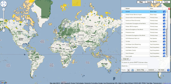
[Screenshot of the GID mapping protected areas and islands]

The Global Island Database aims to enhance the participation and role of islands in international decision-making through identifying and bringing together existing sources of data and information relevant to island systems, and presenting new analyses to aid resource managers and decision-making at the island, national, regional, and global level.

The GID also aims to develop linkages, partnerships and collaborations with the wide array of organisations involved in island conservation and decision-making to ensure that the database is up-to-date and relevant, and so it provides a platform for communication and networking.

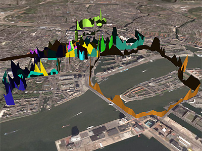
The GID quickly allows you to map things such as sea turtle migrations, the islands themselves, protected areas, diseased/healthy coral regions, etc. A beautiful mapping effort that allows us to view so many interacting environmental events.

Landscape Architecture and Environment Gauging Mobile Technologies

{An augmented reality architectural form, driven by real time environmental information such as temperature, brightness, humidity, wind direction and sound. nodes reflecting the sensor network are the seeds for the virtual architecture, growing and subsiding like an organism. Image via Information Aesthetics}

As technology advances our ability to extract and display information beyond simple pie charts and graphs present new possibilities for understanding our physical environments.  We recently discussed in our CityScene post how these new informational graphics are able to communicate the vast complexities that make up our cities, which more effectively equip landscape architects for proper design.  

The immediacy of social media networks like Twitter, as with the recent swine flu case, has shown how quickly information can be disseminated to the masses.  So why can't we as landscape architects adapt this ability to communicate the status of urban spaces and environments?

An article from SEED has us thinking that this is clearly possible.  “How would it change your ideas about moving around in the world, if you could suddenly sense things you couldn’t see?” asks Eric Paulos, an assistant professor at Carnegie Mellon’s Human-Computer Interaction Institute. Paulos wants to put tiny environmental sensors in cell phones and turn phone users into roving citizen scientists who continuously sample and respond to their personal environment. This type of local and real-time environmental data would not only facilitate science and satisfy individual curiosity, it will empower people to uncover, visualize, and collectively share information about their own neighborhoods and cities. It could ultimately encourage active participation in protecting and improving those spaces.

{Image via Information Aesthetics}

Armed with this new environment gauging technology, spatial and environmental data could be sent to city planning office hubs, which a program monitors and automatically records and displays the readings via data visualization tools.  Geo-spatial mapping taken from camera phones, cell phone usage monitoring will reveal real-time urban space usage and tell the effectiveness of these areas.  Certain cell phone technologies that are able to detect moods from visitors once recorded will also enable psychology of space mapping.

These technologies will also monitor urban micro climates, and any pollution effecting these areas, which will allow officials to immediately act to resolve any issues.

{Image via Information Aesthetics}

This has vast implications for landscape architects.  Much of our work is commissioned after long and laborious case studies show that a certain space has been improperly designed or simply no longer relevant due to an evolving cityscape.  By this time, complete and costly renovations have to be made, but long after these spaces have laid in a state of social and environmental disrepair.

With advanced interactive environment gauging mobile technologies, landscape architects can be quickly and more abundantly engaged in design solutions.  They'll immediately be provided with the recorded mappings and data visualization graphics which they will use to resolve urban design and environmental inefficiencies.

During this time of severe economic slowdown, we as landscape architects need to embrace a paradigm shift of how we approach the profession and become a part of the design and development of advanced social/environment measuring media, not only will it better equip us to properly do our jobs, but it will provide vast amounts of work for our profession.

Let's get a dialogue going of the possibilities. 

{In this visulisation the height of each track point indicates that individuals physiological arousal at that geographic location. Image via BioMapping}{Detail of Greenwich Emotion Map. Image via BioMapping}+ Information Aesthetics

+ BioMapping

+ Related | CityScene | Urban Biorhythmicity | SpatialKey: Geotemporal Mapping